Dr Lakhankar’s teaching interests focusing on areas of core civil engineering including hydraulics and hydrology, groundwater and soil remediation, water resources and environmental engineering. He primarily interested in integrating remote sensing and geographical information system into a wide range of civil engineering issues that include environmental engineering, hydrological modeling, water resources, and transportation engineering. Additionally he is interested in teaching courses in the application of computer programming and statistics to civil engineering as courses of this type will prepare graduating students for easy transition into the workplace. I encourage the use of computational packages (HEC-RAS, HEC-HMS, SAS, SPSS, MODEFLOW, ERDAS) related to the courses, so that graduating student develop some proficiency in the tools used by professionals.
List of courses taught at The City College of New York:
Summer Workshop for Undergraduate and High School Students in Remote Sensing and GIS.
| Summer Bridge and REU (UG) – GIS Module | HIRES Program (High School) – GIS Module | UMES Geosciences Program (UG) – Remote Sensing and GIS Module |
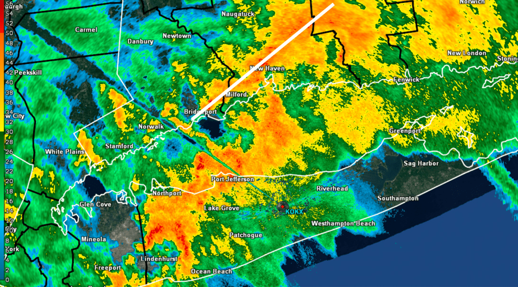
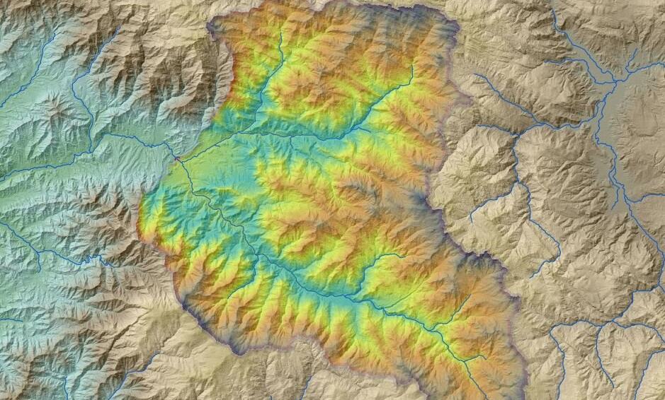
In this course students will learn how to use the underlying concepts of Geographic Information Systems for problems in Water Resources engineering. We will start with a review of the basic concepts of GIS, such as the use Coordinate systems, projections, data concepts, and geographic references. After refreshing this knowledge we will apply these concepts to typical hydrologic tasks, such as Terrain modeling, watershed delineation, computation and extraction of river and watershed networks including spatial analysis computations. Once we have mastered that the course will also introduce some modeling concepts and expand on the integration of time series and geospatial data in general. We will also add some components that address remote sensing data products and their analysis within the GIS environment. The course will be rounded out with some special topics related to challenges that remain for geospatial information systems, such as data heterogeneity, data about data (metadata), and how one can search best for data.
The goal of this course is to develop an understanding of geographic space and how maps represent geographic space. In this class you will learn about the basic principles of maps, their specialized contents, and how to create these maps. The class will also address approaches to map projections, reference systems, and where to find locations. The class will introduce you to basic objects such as points, lines, and polygons in addition to features and ways to organize these in classes. It will also cover principles of geographic information systems, learn about spatial analysis, and how to represent data via data models such as raster and vector formats in addition to store and organize data in a geo-database. You will get hands on experience in using GIS software and acquire basic skills to insert, create, and extract data from different sources in addition to manipulating these in the GIS environment. 4 hr/wk; one 2.0-hour lecture; one 2.0-hour Lab, 3 cr.

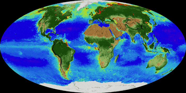
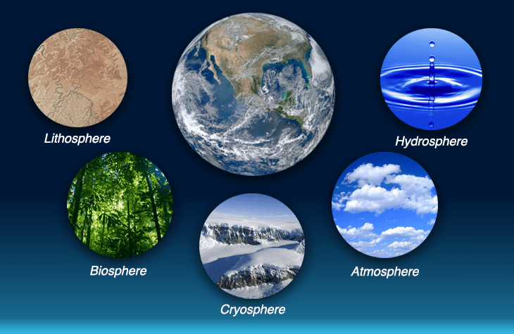
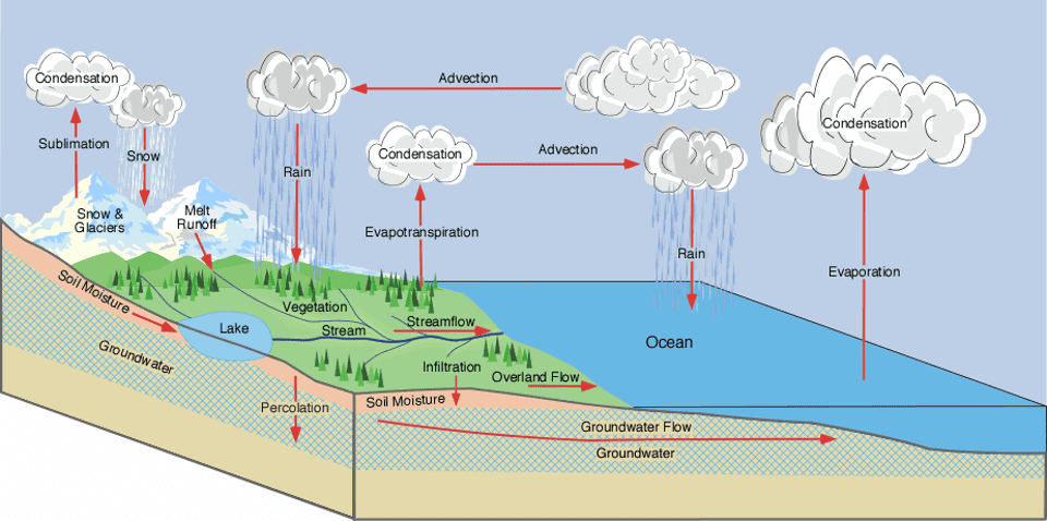
This course focuses on Earth as a system and explores the interdependent relationships among the atmosphere, hydrosphere, biosphere and lithosphere. Through inquiry-based laboratories and field investigations students learn to take scientifically valid measurements in the fields of atmosphere, hydrology, soil and land cover/phenology. Students will gain experience in the analysis and mapping of scientific data, will design and investigate their own science inquiry, and present oral and written reports to their peers. The goal of this course is to provide an integrated background in earth system science and to become proficient at scientific practices including asking questions, developing and using models, planning and carrying out investigations, analyzing and interpreting data, using mathematics and computational thinking, constructing explanations, engaging argument from evidence, and obtaining, evaluating, and communicating information.
The aim of this course is to give civil engineering majors a basic understanding of flow systems in closed and open hydraulic and hydrologic systems. This course is designed to provide detail computation for studying, analyzing and design of components of hydraulic systems such as pipes, pumps, open channels and storm collection systems. Included in this course will be two hydraulic laboratory experiments and three computer lab experiments using a commercial software (i.e. Haestad-Method© software) which help students to design and visualize different hydraulic and hydrological phenomena in professional manner.